This two day workshop and seminar will enable participants to explore and learn on digital approaches in landscape archaeology, with a specific focus on mobility analysis.

Seminar (June 18th, 9h – 13h)
Location: MSH Clermont-Ferrand, salle 332
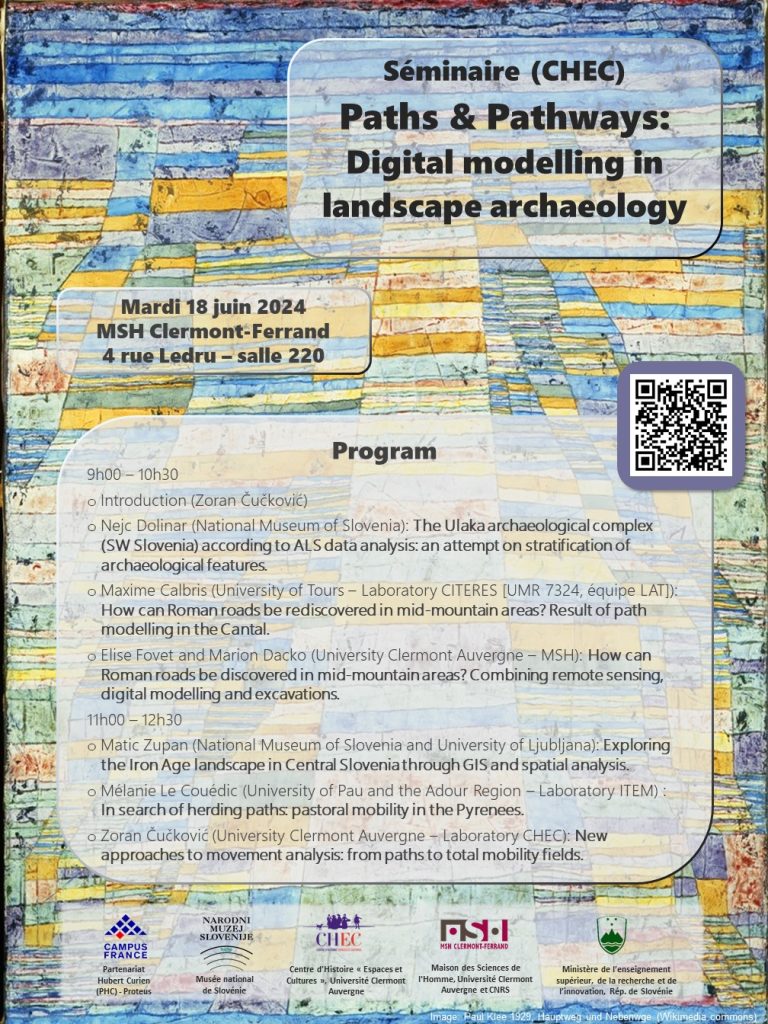
Program:
9h00 – 10h30
- Introduction (Zoran Čučković)
- Nejc Dolinar (National Museum of Slovenia): The Ulaka archaeological complex (SW Slovenia) according to ALS data analysis: an attempt on stratification of archaeological features.
- Maxime Calbris (University of Tours – Laboratory CITERES [UMR 7324, équipe LAT]): How can Roman roads be rediscovered in mid-mountain areas? Result of path modelling in the Cantal.
- Elise Fovet and Marion Dacko (University Clermont Auvergne – MSH): How can Roman roads be discovered in mid-mountain areas? Combining remote sensing, digital modelling and excavations.
11h00 – 12h30
- Matic Zupan (National Museum of Slovenia and University of Ljubljana): Exploring the Iron Age landscape in Central Slovenia through GIS and spatial analysis.
- Mélanie Le Couédic (University of Pau and the Adour Region – Laboratory ITEM) : In search of herding paths: pastoral mobility in the Pyrenees.
- Zoran Čučković (University Clermont Auvergne – Laboratory CHEC): New approaches to movement analysis: from paths to total mobility fields.
Lecture talk (June 18th, 18h – 19h)
by Boštjan Laharnar, Head of archaeological departmenet, National Museum of Slovenia
Location: MSH Clermont-Ferrand, amphithéatre 219
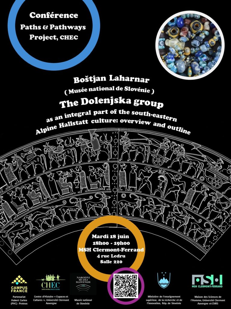
The Dolenjska group as an integral part of the southeastern Alpine Hallstatt culture: Overview and Outline.
Boštjan Laharnar will present us the splendours of Slovenian Iron Age, widely known for its “art of situlae”. Located at the crossroads between the Mediterranean and the Continental Europe, the area of today Slovenia has seen the emergence of hierarchical societites which developped a peculiar lifestyle, borrowing from local and mediteranean traditions.

Situla from Vače, Slovenia (5th c. BC).
Workshop (June 19th, 9h – 12h30)
Location: MSH Clermont-Ferrand, salle informatique 26
Topic: This practical workshop will allow participants to learn about GIS mobility modeling (calculation of the optimal path, surface-time, etc.), as well as visibility analysis (landscape impact of structures, intervisibility networks, etc.). We will discuss these approaches through practical case studies, based on archaeological data.
Prerequisites: Familiarity with GIS (data management, undestanding the principle of vector and raster layers). We will use the QGIS software.
Inscription : send me a message / envoyer moi un message via le formularie sur la page “About”.
=FR= …c’est vraiment en anglais ? Eh oui, mais les organisateurs sont tout à fait disponibles pour des traductions/eclaircissements à tout moment.
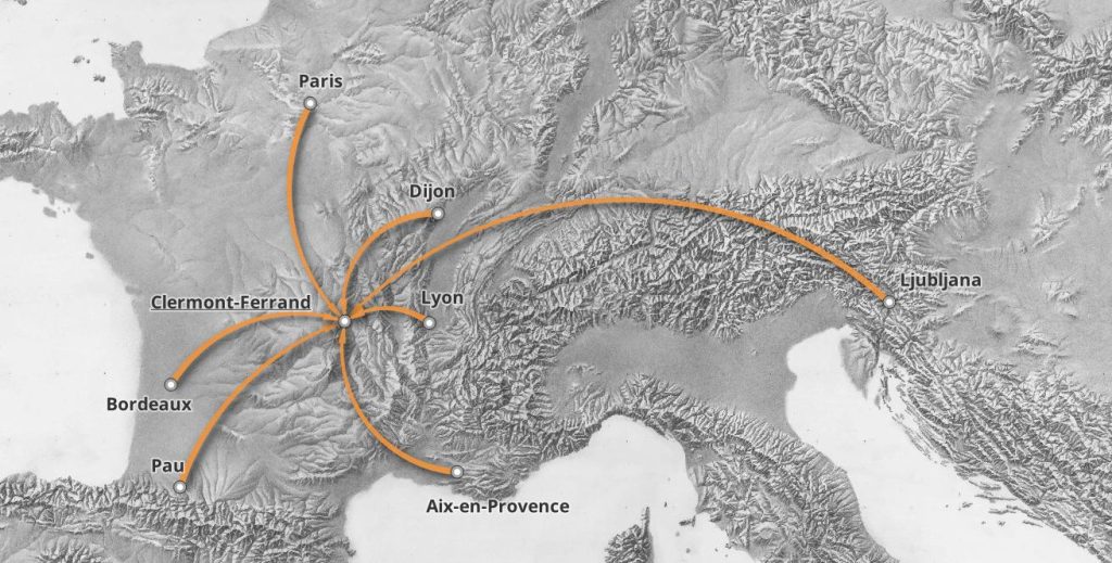
Origins of workshop participants.